


Staff Review
Photos
Witness the Austere Grandeur of Oberg Mountain!
Written by: Barb Daugs
Rating:
The Bottom Line:
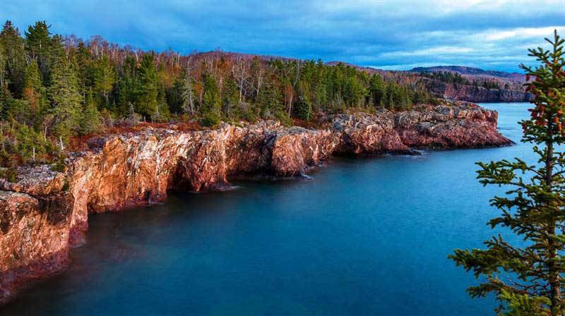
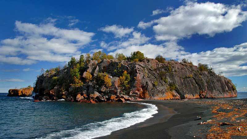
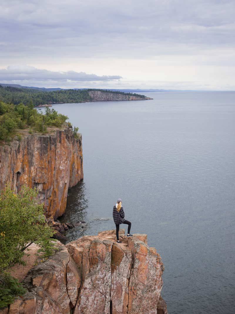
An Awe Inspiring Lake Superior Summit Hike! A Minnesota favorite spur trail off of the famous Superior Hiking Trail. Oberg Mountain boasts a 1555 foot elevation, featuring a 1.8 mile loop that skirts the summit hosting 9 spectacular steep cliff vista overlooks! You will experience profound beauty only viewed by foot travel. The summit features views of......Leveaux mountain & valleys that cascade into Lake Superior with a distant view of Carlton Peak. A panoramic expanse of the brilliant blue waters of Lake Superior as a back drop to a birch, pine and maple studded valley. In the east, Moose Mountain cascading in the distance to the Lake. Then to the north, lush, back hills carpeted with maple, birch, aspen, pine, & spruce cradling the glistening Oberg Lake in its valley. This hike is fantastic any time of year. However, hands down, a fall spectacular NOT to be missed. I have been known to drive to the North Shore from the twin cities for a day hike and then drive home.
Trail Details: Easy to Moderate Hike. I say this because the path is wide and well worn. Dirt trail that is interspersed with some rocks and revealed tree roots. You start the trail by ascending a switch back trail to the top summit trail loop. It takes me 20 minutes to reach the top summit trail with many stops to catch my breath. That 1.8 mile summit loop is pretty easy not as much work.....Especially because you stop quite often to take pictures! It entails a more gradual up and down path that is well worn. But getting to this summit trail you will need to work a bit. However, I easily can hike this entire 3.3 mile trail pretty easily, and I am 58 and not in perfect shape. I just take my time. It is worth the effort.
Popular Trail: Heavily used due to its popularity. Especially weekends. Less used weekdays.
Hiking, Snow Shoeing, Cross Country Ski trail at parking lot -moderate to difficult
Family Friendly: Easy Family Hike - A fun adventure - easy too for back packing small children up it. We as grandparents have hiked up it with our sons and families. 5 year old and preschool did fine going their speed. Son's had back packs for young toddlers. They said it wasn't bad on them. However: Dangerous cliffs - keep young children hand held. Teens beware too - we have had teens who were not careful fall off the cliffs on the north shore.
Note: Snow shoeing - excellent. Caution: Watch for snow drifts along the cliffs that may be over a drop off. You may find yourself on the valley floor below.
Directions:From Tofte, take Highway 61 North approximately 4 1/2 miles. Turn left onto Forest Road 336 (Onion River Road)Proceed up the Onion River Road for about 2 miles to the parking area on the left.
General Notes:The parking area is Oberg Mountain and for LeVeaux Mountain Trail.
Parking:Parking lot on the left hand side of Forest Road 336. Plowed in winter.
Restroom: Commercial Out House. Good supply of toilet paper usually. Well Maintained even in winter.

When you come to the Summit trail loop - hike it clock wise. This is the first overlook toward Leveaux Mountain. As you can see, brilliant fall color bursts becomes a symphony of colors that whimsically uplifts the heart.
Lorem ipsum dolor sit amet, consectetur adipiscing elit. Mauris quis tincidunt leo. Duis gravida rhoncus neque laoreet pulvinar. Phasellus vitae nulla non mi elementum rutrum a sed velit. Phasellus elementum sapien a dui maximus, nec ullamcorper urna feugiat.Lorem ipsum dolor sit amet, consectetur adipiscing elit. Mauris quis tincidunt leo. Duis gravida rhoncus neque laoreet pulvinar. Phasellus vitae nulla non mi elementum rutrum a sed velit. Phasellus elementum sapien a dui maximus, nec ullamcorper urna feugiat.

On Oberg Mountain vista looking at Oberg Lake
Lorem ipsum dolor sit amet, consectetur adipiscing elit. Mauris quis tincidunt leo. Duis gravida rhoncus neque laoreet pulvinar. Phasellus vitae nulla non mi elementum rutrum a sed velit. Phasellus elementum sapien a dui maximus, nec ullamcorper urna feugiat.Lorem ipsum dolor sit amet, consectetur adipiscing elit. Mauris quis tincidunt leo. Duis gravida rhoncus neque laoreet pulvinar. Phasellus vitae nulla non mi elementum rutrum a sed velit. Phasellus elementum sapien a dui maximus, nec ullamcorper urna feugiat.
Lorem ipsum dolor sit amet, consectetur adipiscing elit. Mauris quis tincidunt leo. Duis gravida rhoncus neque laoreet pulvinar. Phasellus vitae nulla non mi elementum rutrum a sed velit. Phasellus elementum sapien a dui maximus, nec ullamcorper urna feugiat.Lorem ipsum dolor sit amet, consectetur adipiscing elit. Mauris quis tincidunt leo. Duis gravida rhoncus neque laoreet pulvinar. Phasellus vitae nulla non mi elementum rutrum a sed velit. Phasellus elementum sapien a dui maximus, nec ullamcorper urna feugiat.
Trail Features
Trail Difficulty
Moderate/ Easy
Round Trip Hours
1 to 1 1/2 Hrs
Round Trip Miles
3.3 Miles
Elevation Gain
1555Ft